This is a departure from my usual subject matter, but having fruitlessly scoured the internet for information in about hiking around Lake Annecy in English, I thought I would fill the most obvious void.
La Tournette (2351m, 7713ft) is the highest peak overlooking Lake Annecy in the French Alps. It looks like a castle atop a series of seemingly impenetrable limestone cliffs, but as with most mountains in the Alps there are several well-worn trails to the summit.
Finding English descriptions of these trails on the internet is the trickiest part of the journey. Here is a description in French.
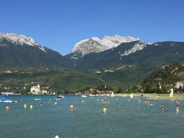
On the Annecy side of the mountain the adventure starts in the Montmin valley, which is separated from the lake by a popular cycling route over the Col de la Forclaz.
From the village of Montmin I headed up the valley towards the Col de l’Aulp, before climbing to the summit from the north. I returned via the less popular southern Chavert route.
From the church in Montmin (1,000m, 3250ft) climb out of town on the one road that heads directly up the hill. Soon you will get to a junction. The left fork traverses below La Tournette and leads to the Col de l’Aulp. The branch that continues straight up the hill is the southern approach to the summit.
I choose to do the long traverse at the beginning of the day when the shade was greatest and I wasn’t suffering “Get-home-it is”. Having climbed out of the village it was a fairly level traverse through the forest to Les Pres Ronds. This is the end of the sealed road and as such is an alternative starting point. From there the trail climbs up to Col de l’Aulp. The signposts indicate you should follow the dirt road as it makes a circuitous way uphill, but the trail behind the sign provides a more direct route free of cyclists and cars.

The Chalet de l’Aulp is the last place to get drinking water. From there the trail switchbacks up the shoulder of the mountain until it is above the line of the first set of cliffs. It then traverses a basin above the escarpment past a shuttered Chalet before climbing onto a terrace above a second line of cliffs. After backtracking along this terrace, the trail switches back and picks its way up through third set of cliffs leading to the summit terrace.
On the French topo map this was indicated as the most difficult section of the trail. There were chains to help you navigate the more exposed sections but in reality only those particularly sensitive to drop offs needed the security they provided. Despite La Tournette’s vertiguous aspect at no point did I feel a slip would be fatal.

It took me just over three hours to reach the summit terrace from Montmin. That was much faster than indicated on the trail signs, but I was moving quicker than most of the other hikers.
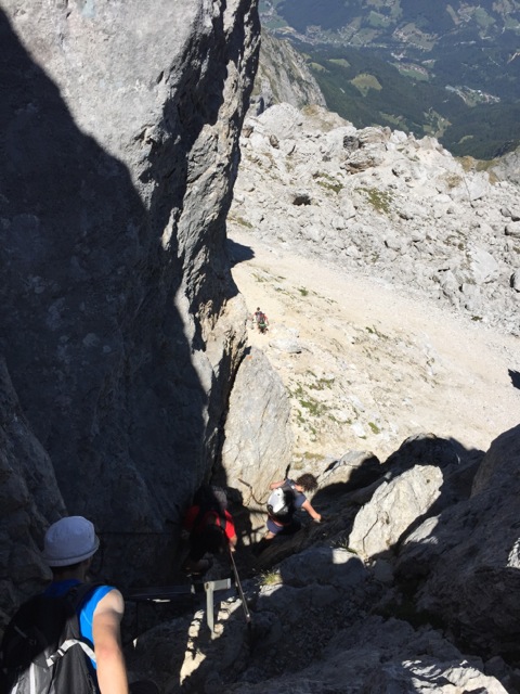
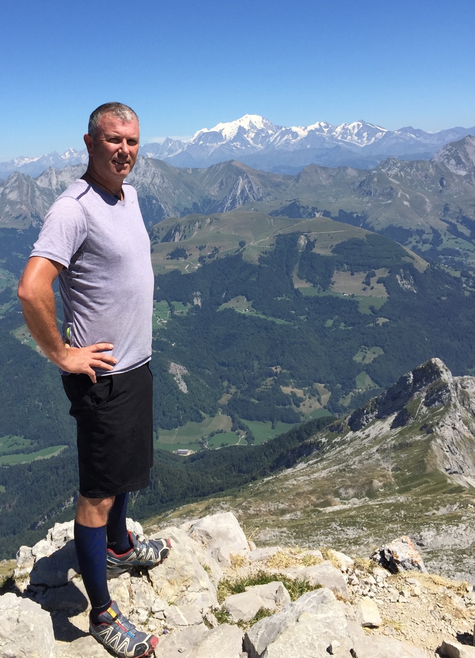
The true summit is on a small escarpment above the summit terrace. Take the trail to east side of this escarpment to find the route to the top. This is marked with chains and has two metal ladders, which can be a bottleneck. While you wait for the downhill traffic to clear you can enjoy a fabulous view of Mt Blanc and the high Alps directly to the east.
From top of the mountain, range after range the ice-capped peaks file from east to south toward the Mediterranean. To the northwest is Lake Annecy and hills leading to Geneva.

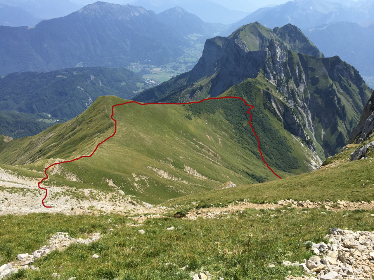
Most hikers descend to the way they came up. I traversed along the summit terrace overlooking the Montmin valley towards the Chavert drainage. The descent into the drainage was on loose step rock. It was the only point I regretted not having my trekking poles.
After a wide loop around the basin at the top of Chavert, the trail dropped into a narrower canyon, before entering the forest for the final descent into Montmin.
As you rounded the upper basin, there was a section that past through Krummholtz-like beech forest. The trail followed a watercourse which would not be much fun if it was raining.
I hiked in the first week in August. It had been a light winter. There was no snow and most of the wildflowers had finished blooming. Only two small streams crossed the trail. One senses they would be an unreliable source of water during a hot dry summer, or if you are queasy about animals pooping upstream. The more substantial Chavert stream is only accessible from the upper reaches of the canyon, after descending from the basin past the ruins of a refuge, and before the trail enters the forest.

The village of Montmin is surprisingly undeveloped for its proximity to Lake Annecy, a popular tourist destination. There is no bar, shop or restaurant so if you are accustomed to a cold beer after a long hike you are out of luck.
Reverting back to Dad mode there were plenty of children doing this hike. Enough to give me some pangs of regret that I couldn’t convince my kids to share the experience, but they were lakeside enjoying some quality time with their mother.
